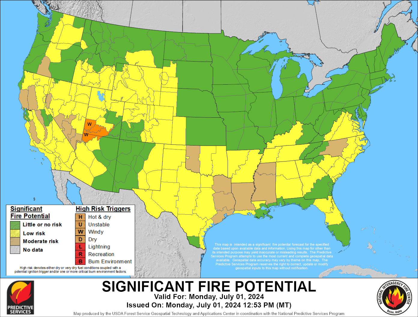
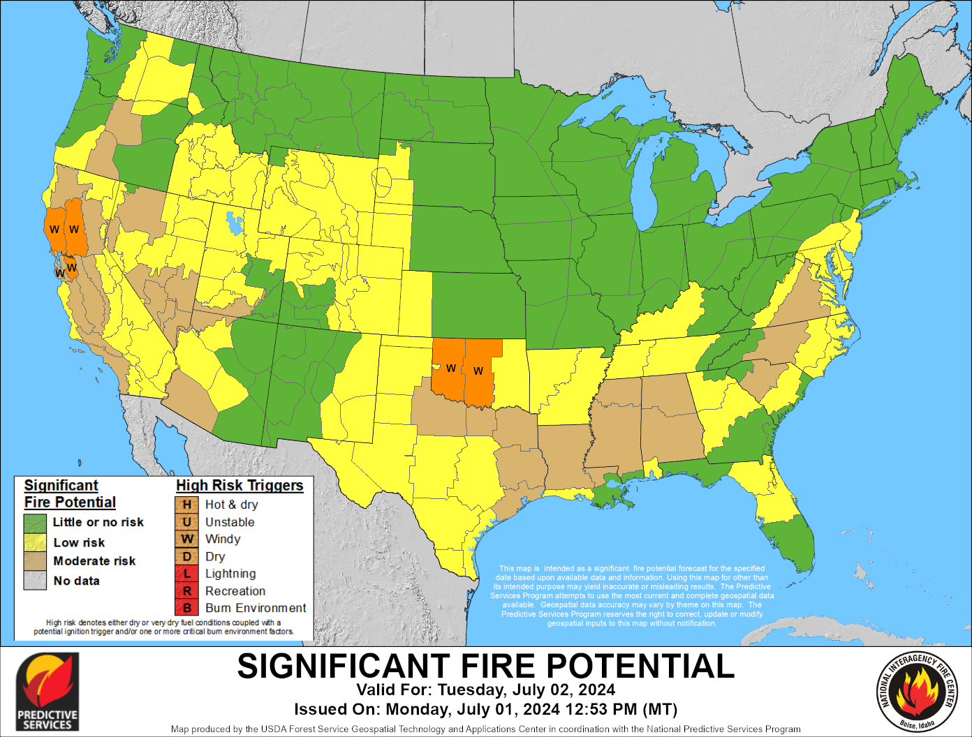
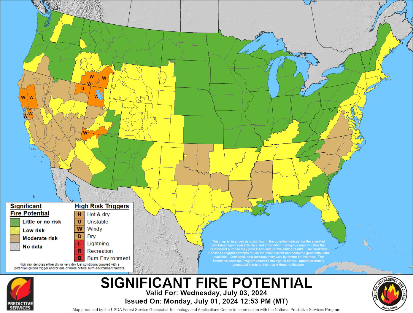
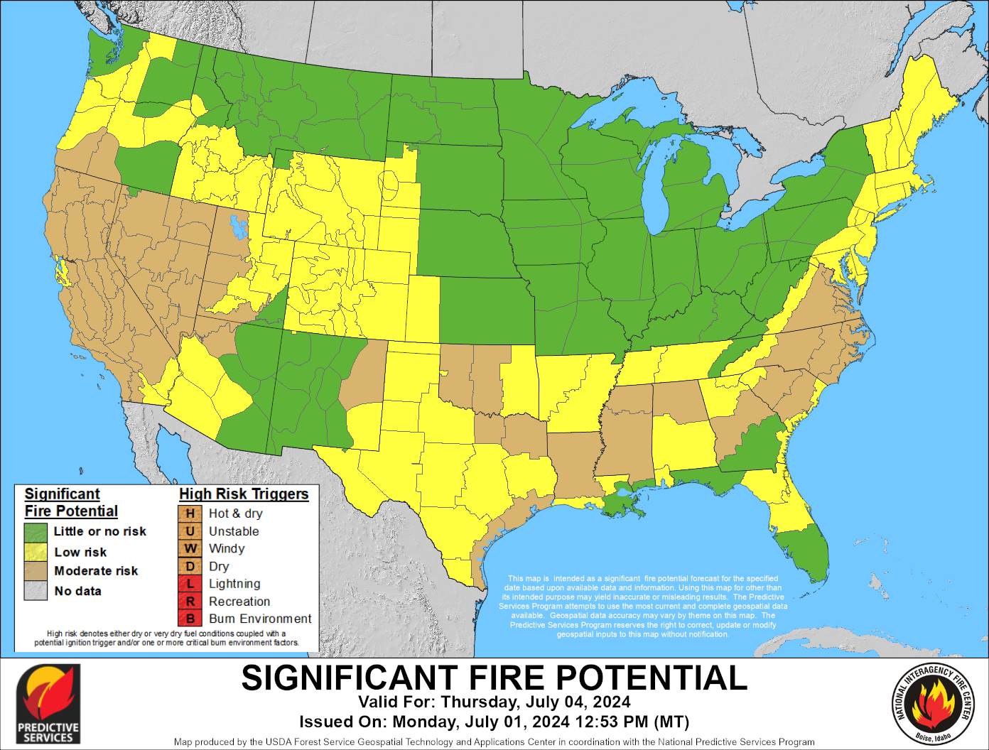
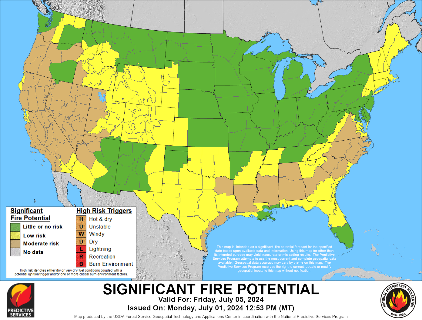
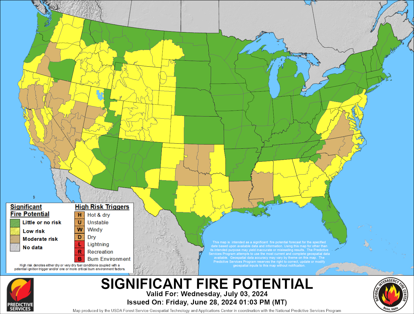
7-Day Significant Fire Potential
These maps are a compilation of Geographic Area 7-Day Significant Fire Potential Outlooks. This product should be fully updated by 12:00 MDT daily.
Note: These outlooks are only issued when Geographic Areas are in fire season and Predictive Services staff are on duty. Check the date carefully when using any map images below. If the images here are not current, use the 7-Day Significant Fire Potential National Viewer.
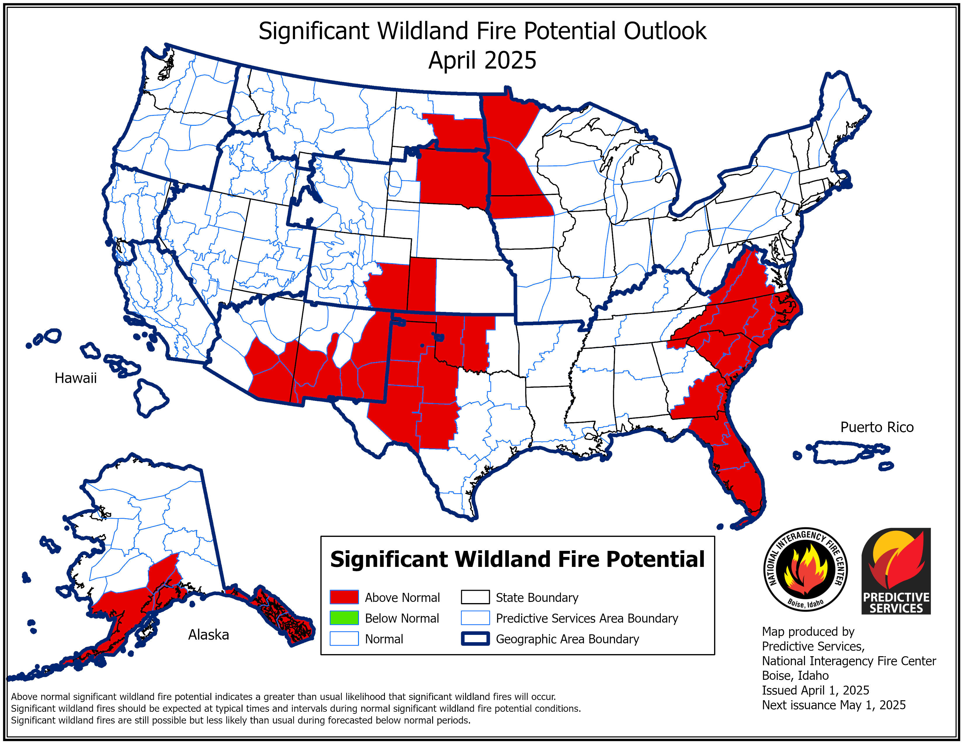
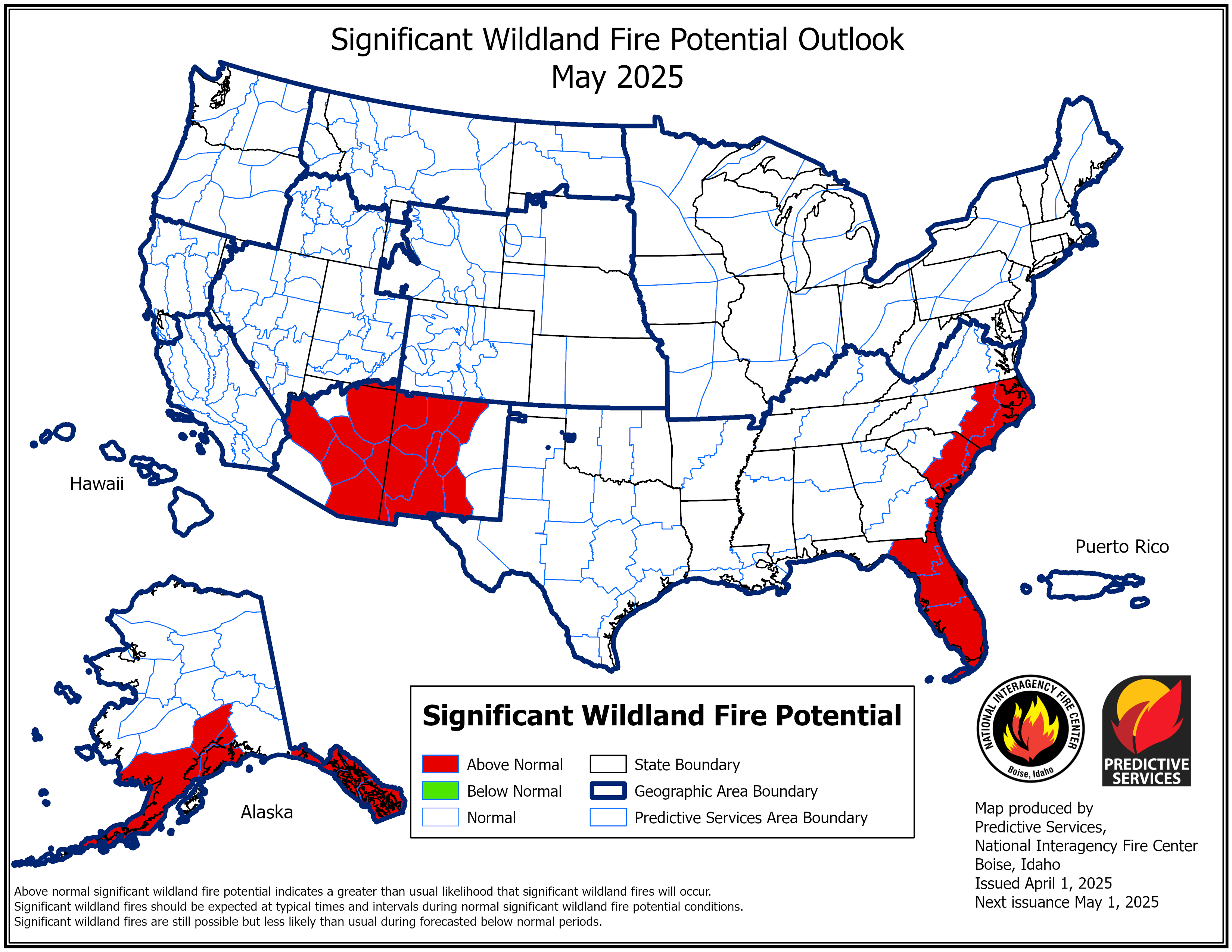
National Significant Wildland Fire Potential Outlook
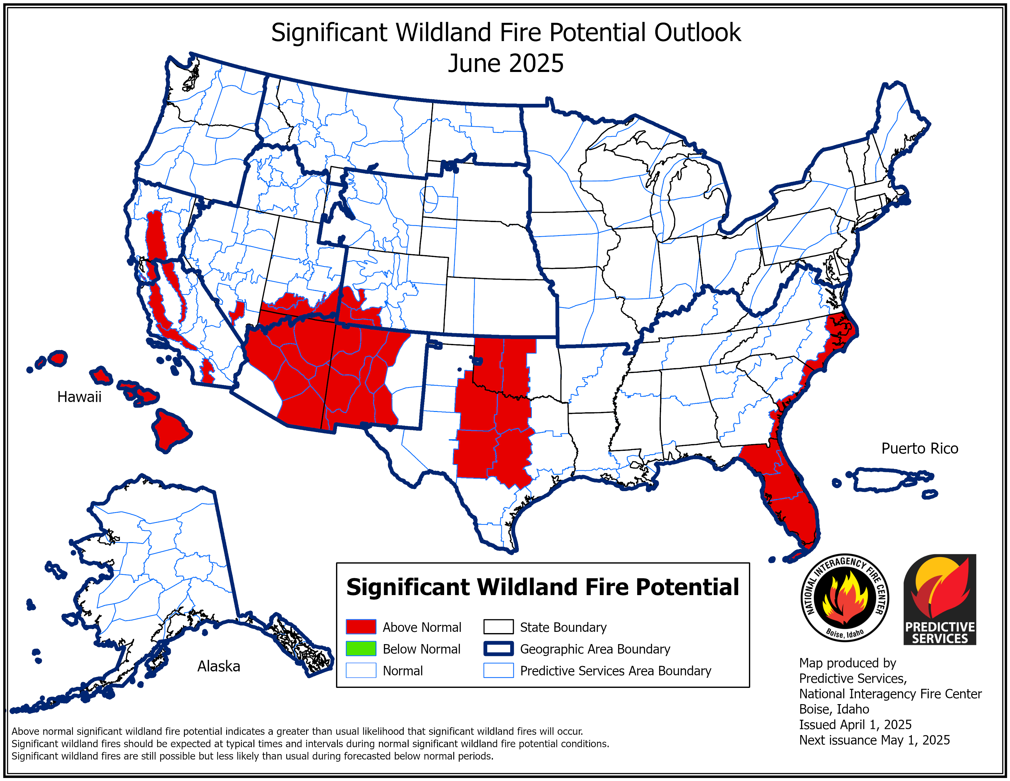
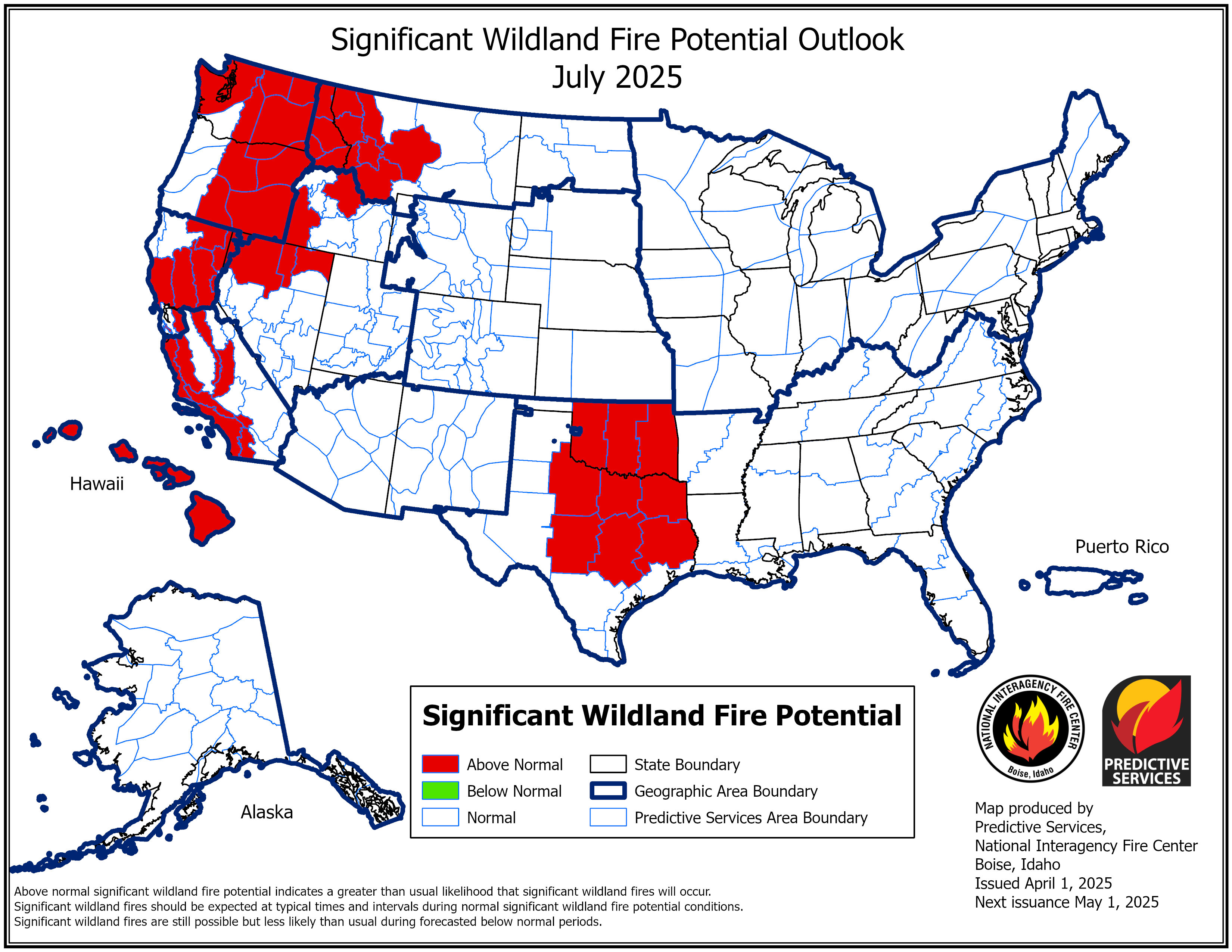
The outlook identifies areas by month for the next four months with above, below, and near normal significant fire potential.
The main objectives of the National Significant Wildland Fire Potential Outlooks are to improve information available to fire management decision makers. These assessments are designed to inform decision makers for proactive wildland fire management, thus better protecting lives and property, reducing firefighting costs and improving firefighting efficiency.
The following maps represent the cumulative forecasts of the ten Geographic Area Predictive Services Units and the National Predictive Services Unit.
The entire text document can be found at the following link, National Wildland Significant Fire Potential Outlook.
This product is updated on the first of each month or first work day of each month.
